From Above the Air...
Best viewed in full-screen format: |
The Arroyo Seco Bridges
In the Highland Park - or "Garvanza" - district of northeast Los Angeles there were, for many years, three substantial railroad bridges across the wide Arroyo Seco within a half mile of each other. (In addition to these three lines was L.A. Railway's "W" line which came up Figueroa then west on York Boulevard to about Avenue 50. Quite a railfan paradise in years past.)
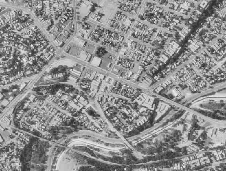
Below are two images of the same satellite photo. In the lower picture I have drawn in the track locations as best I can determine them. Any corrections would be appreciated...just drop me an email.
Downtown Los Angeles is below and somewhat to the left of this map, while South Pasadena and Pasadena are above and to the right.
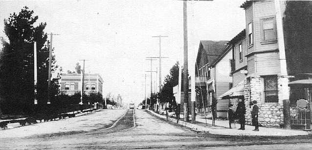
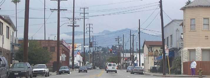
Below the map images are two views, nearly a century apart, of Avenue 64 & Roble, where the Avenue 64 "Church of the Angels" Line branched off the old Pasadena Main Line
Northernmost, the UP Pasadena Branch crossed the Arroyo Seco on the 750-foot long concrete-arch York Boulevard bridge. The track was in pavement in the center of York Blvd from about 250' east of Figueroa Street. Immediately west of the bridge the track shifted to the north side of the roadway (westbound "curb" lane). Once east of the bridge, it entered private right-of-way on the north side of the road, which became Pasadena Avenue.
Southern California's first interurban line, and Pacific Electric's original line to Pasadena, referred to as the Pasadena Main Line or the South Pasadena Line, spanned the arroyo on a combination wood and steel bridge, about 900 feet long. It was built in 1895 and rebuilt in 1903. On the east bank of the arroyo, and partially under the PE bridge was "Cawston's Ostrich Farm," a popular tourist attraction from about 1900 until the early 1930's...when ostrich plumes and money both went out of style.
Farthest south, the Santa Fe's massive steel viaduct can be seen quite clearly. This structure stretched nearly a quarter of a mile across the ravine, and carried ATSF "Second District" trains between Los Angeles and Pasadena, Monrovia and San Dimas to San Bernardino and east. The abuilding Pasadena "Gold Line" will follow the Santa Fe right-of way for most of its proposed route.
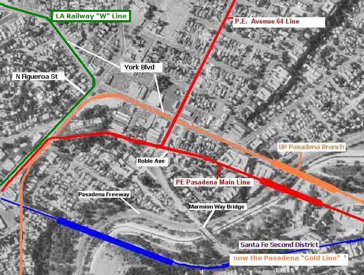
West of the PE bridge, at Avenue 64 and Roble Ave, was the junction with PE's "Avenue 64" Line, also known as the Annandale or Church of the Angels Line. This line was first projected to go north to the area of today's "134" Freeway and thence east into Pasadena, but instead it went only about a mile and a half up Ave. 64.
Below are two views of the intersection of Ave 64 & Roble, taken nearly a century apart. Note the old cable-car body at the extreme right in the 1907 photo, which gave passengers a spot to wait out of the weather; also the rails of the Pasadena Line can be seen in the roadway along the bottom. The building on the right with the "cupola" still stands intact; in the left background, the two-story brick building at York Blvd still stands in 2002, but the rooftop and other decorative brickwork were all removed after damage in the October 1987 Whittier earthquake.
 |
circa |
 |
January |