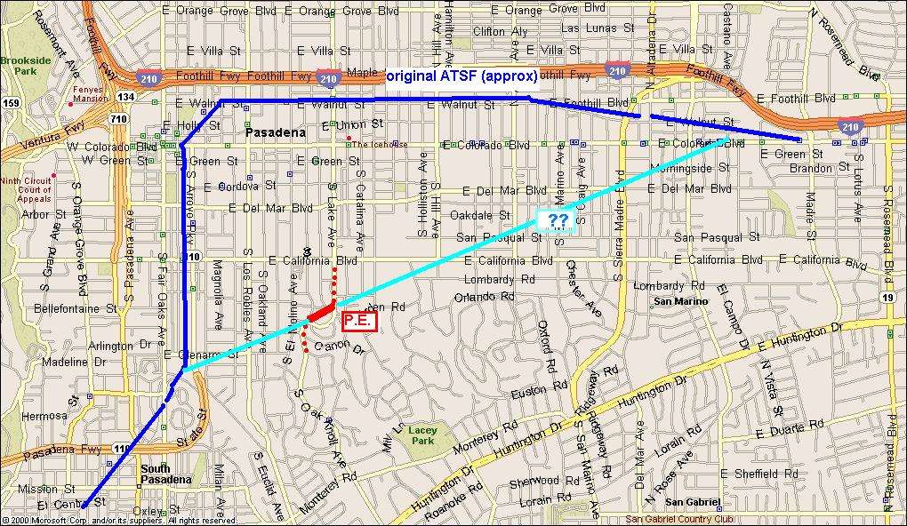
ATSF "Marceline Cutoff" ?
Pasadena, 19th Century ?
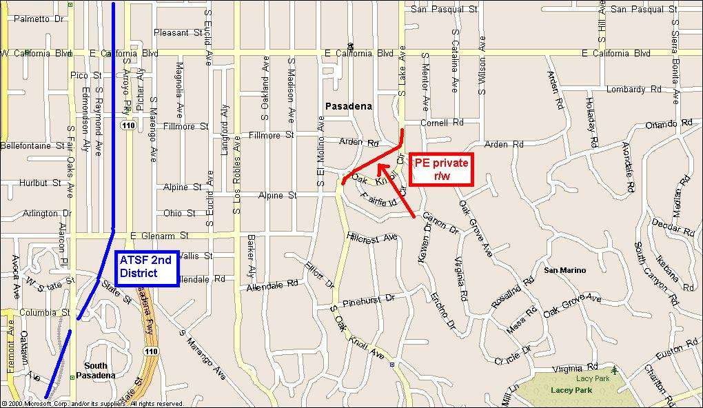
PE Pasadena - Oak Knoll Line private way
Did Santa Fe have a cutoff something like this?
When was it in service?
New info... 3/28/2004
Here's a tantalizing clue about this... Below, the 1910 Sanborn maps show a Santa Fe line branching off the 2nd District at "Raymond Station" just south of Glenarm, almost exactly where the blue lines (above) intersect... headed northeasterly. The area not having been built up yet in 1910, the Sanborn Insurance maps don't go any farther out. Also, the previous map edition, dated 1903, does not extend east beyond Marengo.
More... 3/29/2004
Info from Charles Seims, Gary Meyer, and Donald Duke is that the "Marceline Cutoff" ran from Santa Fe's Raymond station, near present-day Glenarm Street, just west of the Pasadena Freeway, diagonally to a junction in the Lamanda Park area, near today's Walnut Street, just east of Sierra Madre Blvd. It operated from about 1887 to 1899. (So my "guess" map above wasn't too terribly far off... dumb luck).
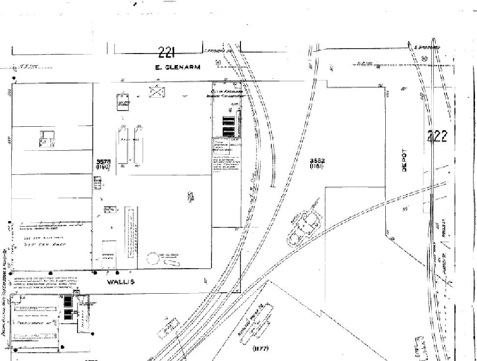 |
 |
| These map pages are
dated 1910. Note the apparent extension of the old right-of-way
alignment at the right, which would be the northwest
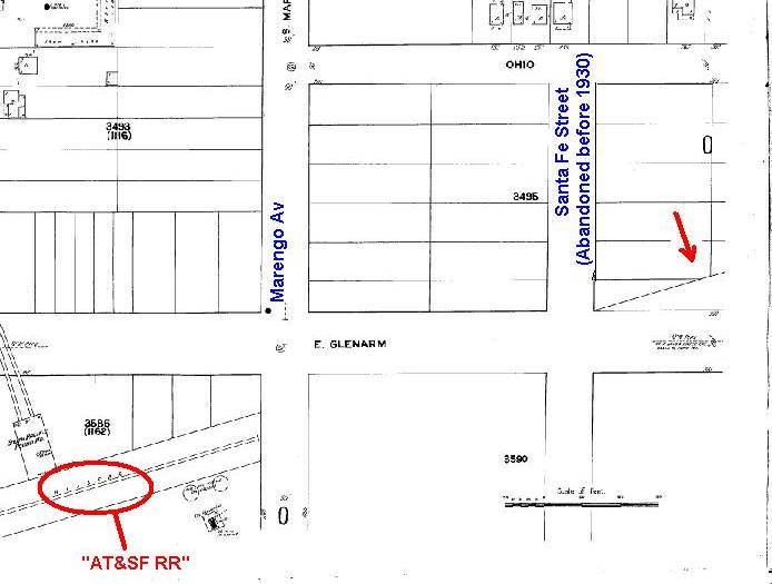
corner of Euclid & Glenarm. (By 1930, the ATSF tracks ended just west of Marengo with a "car shed" and buildings of the Pasadena Orange Growers' Assn. Santa Fe Street had been abandoned and became private property. |
|
Email: RedCars@gmail.com![]()