| sh2705.gif |
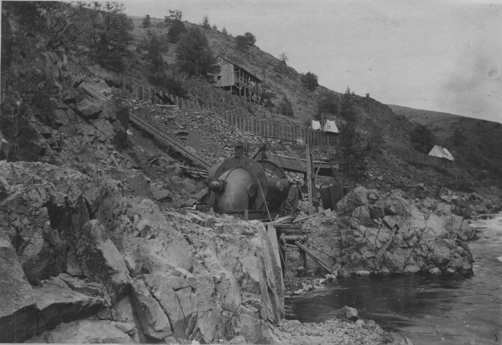
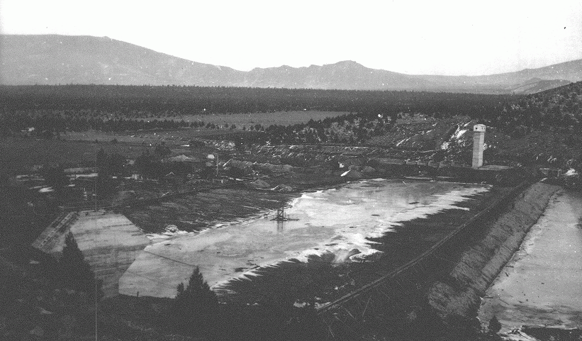
This photograph is of the Prather pump in the Shasta River gorge in 1893. Although it was called a pump, in fact it was an eletrical generator. Water was run through the flume at the top of the photo which was nearing completion at the time of the photo. The flume came from the top of the Shasta Valley past Montague, where it supplied the town water, then downstream to this electrical generator.
| sh2706.gif |
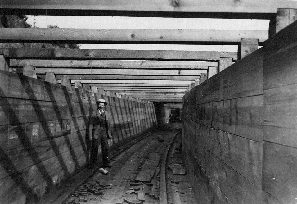
Inside the flume leading to the Prather pump just after it was completed in 1893.
| sh2711.gif |
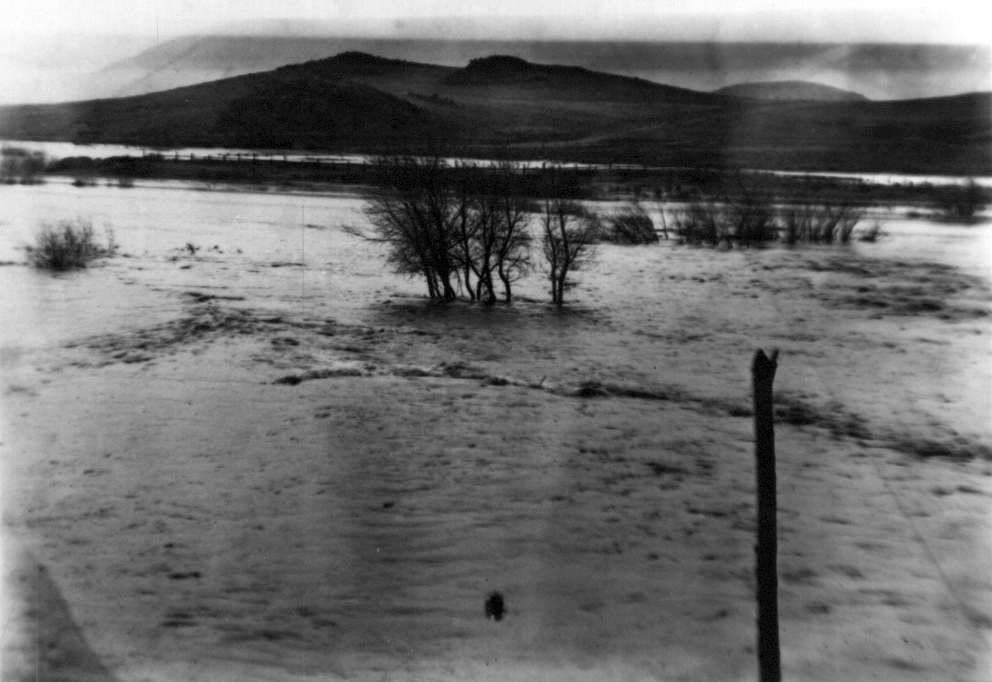
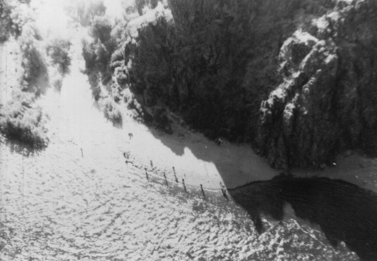
This historical photograph of the Shasta River was taken from the railroad bridge during a major flood early in the century. The exact date of the photo is unknown. Photos such as this from known locations can help understand Shasta River riparian conditions at different times in the past.
| sh3017.gif |
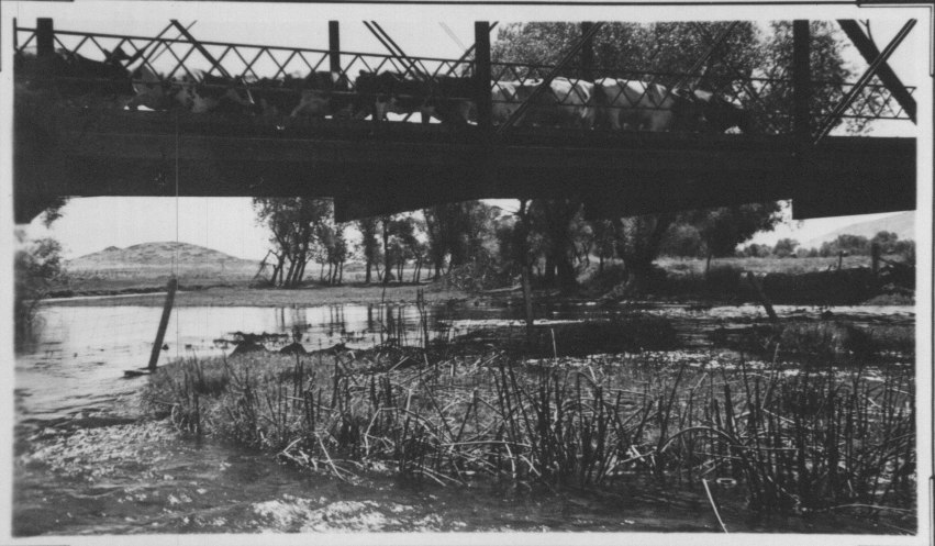
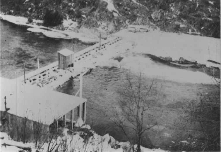
Photo taken of the Montague/Grenada Road bridge and the Shasta River prior to 1948. This photo was likely taken in the late 1930's or early 1940's.
| sh2724.gif |
Mouth of the Shasta River with salmon fishermen circa 1953. The mouth of the Shasta River was an extremely effective place for salmon angling but was closed to fishing in the 1990's to protect Shasta fall chinook stocks.
| sh2723.gif |
The old Shasta Racks on the Dewey Smith property at the top of the Shasta gorge, circa 1953.
| sh2718.gif |
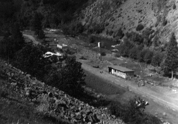
This photo shows the USGS gauging station on the lower Shasta River in 1953. The white shed adjacent to the stream houses the gauge. Note the lack of vegetation and check Picture (sh3095.gif) to see recovery.
| sh3095.gif |
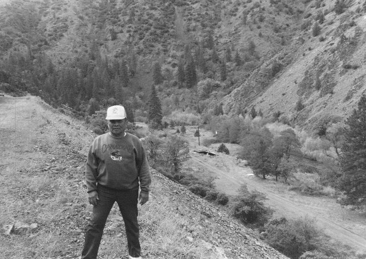
This black and white photo was taken in 1996 at the same location as Picture (sh2718.gif) and shows considerable riparian recovery from the 1953 photo. Note that the white USGS gauging station shed is barely visible through the trees. Bill Balthazar, the property owner at the time is pictured at left.
| trainsh.gif |
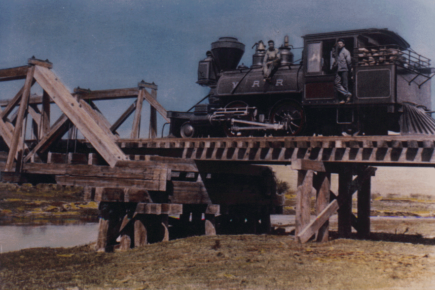
This colorized photo of a steam train crossing the Shasta River near Montague early in the 1900's shows that extensive cattle grazing had already taken place in the riparian zone and that few trees existed at that time to shade the river.
| meam1930.gif |
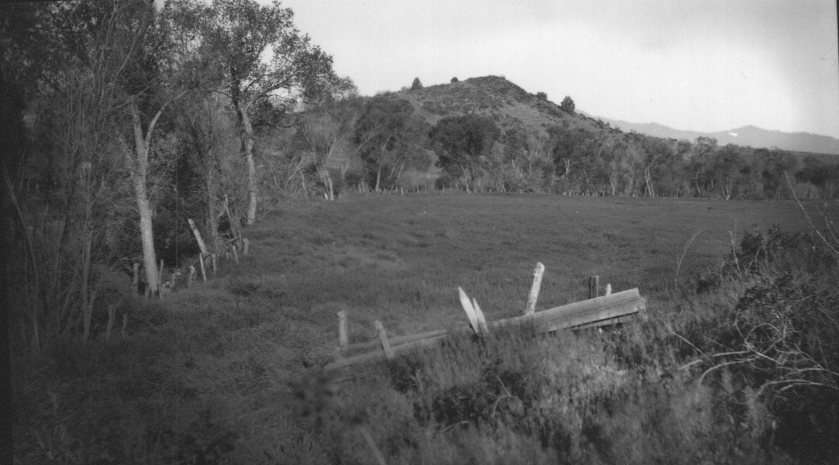
Riparian zone of the Shasta River just downstream of where Montague Grenada Road runs today. The photo was probably taken in the 1930's. Note the old fence which protected riparian trees.
| lemo1930.gif |
Looking southeast across the Montague Grenada Road bridge over the Shasta River. The photo was probably taken around 1930. It shows that some large riparian trees existed in the reach at that time. Gregory Mountain is visible in the background.
| mgr1930.gif |
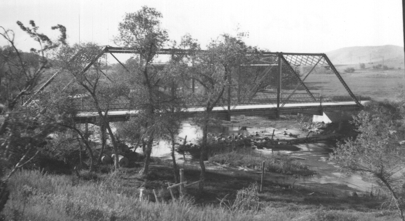
Montague Grenada Road Bridge across the Shasta River indicating a much wider stream channel than is currently found at this location. This photo was probably taken around 1930 not long after Dwinell Reservoir was constructed. Restricted flows from the dam after 1928 probably caused the river channel to narrow.
| dwicons.gif |
Dwinell Dam under construction circa 1926. The dam was built because water shortages in the Shasta River basin were creating substantial conflicts between water users.
| dwinell.gif |
Dwinell Dam as it appeared in 1992. The irrigation ditch seen at upper left in the photo provides water from Lake Shastina for agriculture on the east side of the Shasta Valley down to the Little Shasta River.
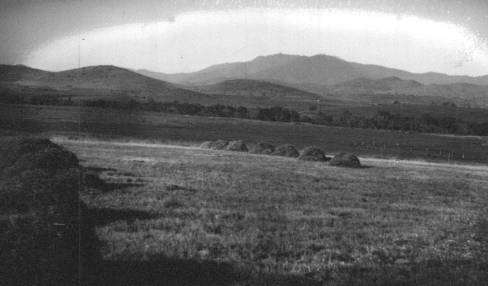
| haystack.gif |
This pastoral scene from an unknown location in the Shasta Valley was probably taken some time in the first half of the twentieth century. It shows a continuous riparian corridor along the Shasta River which runs through the center of the photo.