P.E.'s Proposed Vineyard Subway Right-of-Way
What's left of it today...
--- Satellite photos taken in May, 1994 ---
Images are large and fairly dense...give 'em time to load!
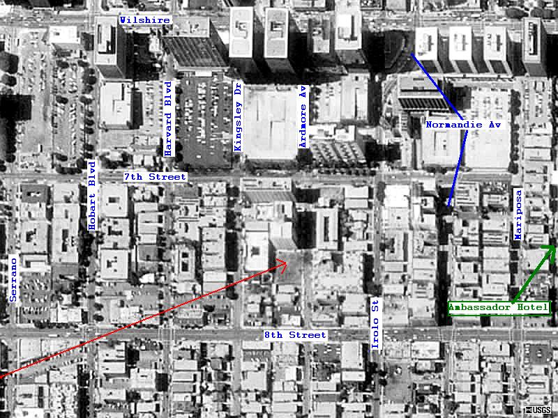
Overall view: Ambassador Hotel to Vineyard Junction
Headed from east to west...
From near 7th & Irolo to 8th & Serrano
CLICK HERE TO SEE THIS MAP "ZOOMABLE" WITHOUT NOTATIONS
From 8th & Kingsley to 9th & Manhattan Place
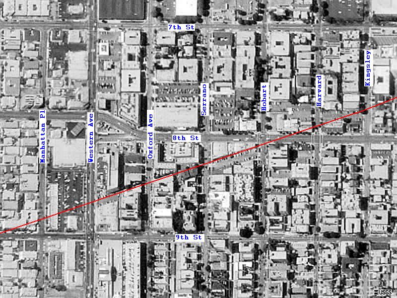
CLICK HERE TO SEE THIS MAP "ZOOMABLE" WITHOUT NOTATIONS
From
Wilton Place near San Marino to Norton south of Olympic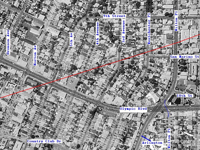
CLICK HERE TO SEE THIS MAP "ZOOMABLE" WITHOUT NOTATIONS
From Victoria near 12th to Pico & St Anne
I'm not so sure of this segment...the west end of it appears to be too far north. Any corrections?? Please email me.

CLICK HERE TO SEE THIS MAP "ZOOMABLE" WITHOUT NOTATIONS
Check out a view of Vineyard and the Rimpau Loop
The part of PE's Subway that did get built
Other railroad sites around Southern California